Topographic Maps
Advertisement
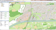
Garmin BaseCamp v.3. 2. 2002
Take charge of your next adventure with BaseCamp, software to view and organize your maps, waypoints, routes, and tracks and send them to your Garmin device. Main Features: -View 24K or 100K topographic maps and other topographic data.
Advertisement
AutoDEM
AutoDEM (aka as AutoMNT) is a freeware GIS software to create Digital Elevation Models (DEM) from scanned topographic maps for Windows. Through different data layers (map, contours, DEM, etc.
Moagu v.2.0
Put Real USGS Topographic Maps, Aerial/Satellite Imagery, Scanned Maps And More On Garmin Handheld GPS Units!
TerraViewer v.1.1
TerraViewer makes use of Microsofts free TerraService web service to retrieve and display archived satellite images and topographic maps of any region in the United States. You can search for regions by long/lat values or by city names.

MoreMaps v.1.1.0.0
Enjoy all the beatiful maps from the Norwegian Mapping Authority. All the way from N-series maps through topographic maps and sea maps. There's even a simple tracking capability that will pinpoint your geographical position, including speed and
Mapster v.1.1
Mapster is a program for creating custom topographic maps of arbitrary size for printing.
WW2D v.1.0
WW2D allows you to explore Earth using satellite imagery, topographic maps and image from other data sources also providing large placenames and boundaries database and allowing you to install community-made add-ons for even more info about our plane
Topos US v.1.1
Topos US is an app that provides access to download and view high resolution USGS topographic maps for the United States.
3DField v.3.7.3
This plotting software converts your data into contour maps and surface plots. It interpolates X, Y and Z data points onto a grid, orthogonally or within an arbitrary border. It also displays data points on a plane,
Fugawi Global Navigator v.4.5.50.5002
Fugawi is a strong bitmap-to-use maps in combination with a GPS receiver. Fugawi offers the capability to calibrate with precision digital maps or scan paper maps. You can also import a large number of official or commercial mapping products.
3DFieldPro v.2.9.2
Create contour maps. 3DField is a contouring surface plotting and 3D data software that runs under Microsoft Windows NT/XP/Vista/7. 3DField converts your data into contour maps and surface plots.